

Severe Thunderstorms Threaten NYC Tuesday With Flash Flooding, High Winds and Isolated Tornados Possible
New York City
Published · Updated

Watch Live Videos
Download Citizen




Summary
- New York City is bracing for a significant severe weather event Tuesday as a strong cold front pushes into the region, bringing multiple rounds of thunderstorms, flash flooding, damaging winds, large hail, and isolated tornadoes.
- NYC Emergency Management has issued a weather alert and activated the city's Flash Flood Emergency Plan.
- The most dangerous period is expected between 4 p.m. and 11 p.m. Tuesday, though periods of rain may begin as early as Tuesday morning.
- Rainfall totals of 2 to 4 inches are expected citywide, with isolated higher amounts possible. Rainfall rates of 1 to 2 inches per hour during the strongest storms could rapidly overwhelm urban drainage systems.
- The NWS Storm Prediction Center has placed the tri-state area at a Level 3 of 5 Enhanced Risk for severe weather.
- NJ Transit has suspended service in both directions during peak storm periods. Subway disruptions are also possible.
- Citizen reminds its users to stay safe:
- Avoid underpasses, low-lying roadways, and areas with poor drainage.
- Never drive through flooded roads — turn around, don't drown.
- Residents in basement and ground-floor apartments prone to flooding should be prepared to move to higher ground if conditions worsen.
- Sign up for Notify NYC emergency alerts by texting NOTIFYNYC to 692-692 or visiting nyc.gov/notifynyc.
- Visit the NYCEM Weather Updates website for the latest information on conditions throughout the city.
Timeline
Floodwaters have risen rapidly, submerging sidewalks and streets with vehicles partially underwater.
Pedestrians and vehicles continue to move through wet streets with ongoing moderate rain.
A fallen tree branch is partially blocking a sidewalk amid storm conditions.
Utility trucks and a bus remain parked as wet conditions persist in the city.
Pedestrians use umbrellas as wet conditions continue during severe thunderstorm warnings.
Firefighters are responding to a building fire producing thick smoke over a bridge in the city.
Smoke is seen rising from a building amidst the severe weather conditions.
Additional user video shows windy conditions along the water beneath the Williamsburg Bridge.
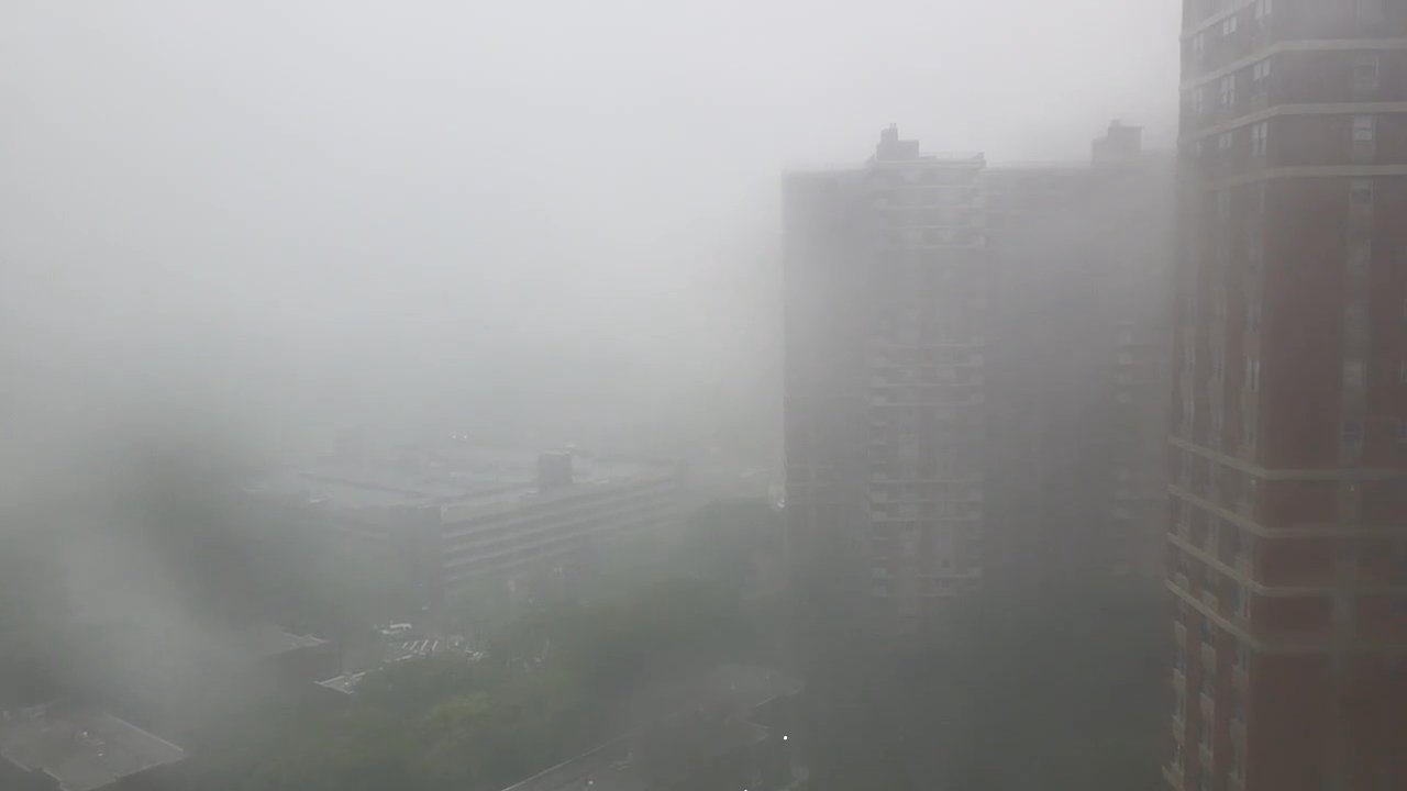
Citizen users show cloudy and windy conditions approaching the area before the rain is expected to begin later this morning and into the afternoon.
Flash flooding will reportedly be a concern for large parts of the I-95 corridor, from Washington DC to Philadelphia to New York City, per ABC News.
Monitor conditions in your area by visiting the [National Weather Service website](https://www.weather.gov/).
Conditions are expected to improve significantly Wednesday night, with drier air and partly sunny skies forecast for Thursday. Highs will be in the lower 80s — well below the dangerous heat levels of last week.
Avoid underpasses, low-lying roadways, and areas with poor drainage. Never drive through flooded roads — turn around, don't drown. Residents in basement and ground-floor apartments prone to flooding should be prepared to evacuate if conditions worsen.
New Jersey Transit has suspended service in both directions during peak storm periods. Subway disruptions are also possible.
Over 630 flights have been cancelled or delayed at JFK, LaGuardia, and Newark airports as of Tuesday morning, with LaGuardia the hardest hit. Contact your airline directly to rebook.
Rainfall rates of 1 to 2 inches per hour are possible during the strongest storms — enough to rapidly overwhelm urban drainage systems. Those most at risk of flooding include North and Central New Jersey, Metro New York City, Long Island, and coastal Connecticut.
A Flash Flood Watch is in effect for NYC and northeastern New Jersey through Tuesday night. Rainfall totals of 2 to 4 inches are expected citywide, with isolated higher amounts possible.
The primary threats include damaging wind gusts up to 65-75 mph capable of downing trees and power lines, large hail, flash flooding, and isolated tornadoes. The greatest tornado and straight-line wind risk is concentrated in the Poconos, Catskills, and New Jersey, though dangerous storms could extend into all of New York City.
The National Weather Service (NWS) Storm Prediction Center has placed the tri-state area at a Level 3 of 5 Enhanced Risk for severe weather — the same level that prompted significant damage during last week's storms.
Periods of rain are expected to begin as early as Tuesday morning, with moderate to locally heavy rain becoming increasingly likely after 4 p.m. Multiple rounds of thunderstorms are most likely between 4 p.m. and 11 p.m. Showers may linger into Wednesday morning.
NYC Emergency Management (NYCEM) issued a weather alert Monday evening and activated the city's Flash Flood Emergency Plan ahead of severe thunderstorms expected Tuesday afternoon and evening.
Incident reported at New York City.
Floodwaters have risen rapidly, submerging sidewalks and streets with vehicles partially underwater.
Pedestrians and vehicles continue to move through wet streets with ongoing moderate rain.
A fallen tree branch is partially blocking a sidewalk amid storm conditions.
Utility trucks and a bus remain parked as wet conditions persist in the city.
Pedestrians use umbrellas as wet conditions continue during severe thunderstorm warnings.
Firefighters are responding to a building fire producing thick smoke over a bridge in the city.
Smoke is seen rising from a building amidst the severe weather conditions.
Additional user video shows windy conditions along the water beneath the Williamsburg Bridge.
Citizen users show cloudy and windy conditions approaching the area before the rain is expected to begin later this morning and into the afternoon.
Flash flooding will reportedly be a concern for large parts of the I-95 corridor, from Washington DC to Philadelphia to New York City, per ABC News.
Monitor conditions in your area by visiting the [National Weather Service website](https://www.weather.gov/).
Conditions are expected to improve significantly Wednesday night, with drier air and partly sunny skies forecast for Thursday. Highs will be in the lower 80s — well below the dangerous heat levels of last week.
Avoid underpasses, low-lying roadways, and areas with poor drainage. Never drive through flooded roads — turn around, don't drown. Residents in basement and ground-floor apartments prone to flooding should be prepared to evacuate if conditions worsen.
New Jersey Transit has suspended service in both directions during peak storm periods. Subway disruptions are also possible.
Over 630 flights have been cancelled or delayed at JFK, LaGuardia, and Newark airports as of Tuesday morning, with LaGuardia the hardest hit. Contact your airline directly to rebook.
Rainfall rates of 1 to 2 inches per hour are possible during the strongest storms — enough to rapidly overwhelm urban drainage systems. Those most at risk of flooding include North and Central New Jersey, Metro New York City, Long Island, and coastal Connecticut.
A Flash Flood Watch is in effect for NYC and northeastern New Jersey through Tuesday night. Rainfall totals of 2 to 4 inches are expected citywide, with isolated higher amounts possible.
The primary threats include damaging wind gusts up to 65-75 mph capable of downing trees and power lines, large hail, flash flooding, and isolated tornadoes. The greatest tornado and straight-line wind risk is concentrated in the Poconos, Catskills, and New Jersey, though dangerous storms could extend into all of New York City.
The National Weather Service (NWS) Storm Prediction Center has placed the tri-state area at a Level 3 of 5 Enhanced Risk for severe weather — the same level that prompted significant damage during last week's storms.
Periods of rain are expected to begin as early as Tuesday morning, with moderate to locally heavy rain becoming increasingly likely after 4 p.m. Multiple rounds of thunderstorms are most likely between 4 p.m. and 11 p.m. Showers may linger into Wednesday morning.
NYC Emergency Management (NYCEM) issued a weather alert Monday evening and activated the city's Flash Flood Emergency Plan ahead of severe thunderstorms expected Tuesday afternoon and evening.
Incident reported at New York City.
Floodwaters have risen rapidly, submerging sidewalks and streets with vehicles partially underwater.
Pedestrians and vehicles continue to move through wet streets with ongoing moderate rain.
A fallen tree branch is partially blocking a sidewalk amid storm conditions.
Utility trucks and a bus remain parked as wet conditions persist in the city.
Pedestrians use umbrellas as wet conditions continue during severe thunderstorm warnings.
Firefighters are responding to a building fire producing thick smoke over a bridge in the city.
Smoke is seen rising from a building amidst the severe weather conditions.
Additional user video shows windy conditions along the water beneath the Williamsburg Bridge.
Citizen users show cloudy and windy conditions approaching the area before the rain is expected to begin later this morning and into the afternoon.
Flash flooding will reportedly be a concern for large parts of the I-95 corridor, from Washington DC to Philadelphia to New York City, per ABC News.
Monitor conditions in your area by visiting the [National Weather Service website](https://www.weather.gov/).
Conditions are expected to improve significantly Wednesday night, with drier air and partly sunny skies forecast for Thursday. Highs will be in the lower 80s — well below the dangerous heat levels of last week.
Avoid underpasses, low-lying roadways, and areas with poor drainage. Never drive through flooded roads — turn around, don't drown. Residents in basement and ground-floor apartments prone to flooding should be prepared to evacuate if conditions worsen.
New Jersey Transit has suspended service in both directions during peak storm periods. Subway disruptions are also possible.
Over 630 flights have been cancelled or delayed at JFK, LaGuardia, and Newark airports as of Tuesday morning, with LaGuardia the hardest hit. Contact your airline directly to rebook.
Rainfall rates of 1 to 2 inches per hour are possible during the strongest storms — enough to rapidly overwhelm urban drainage systems. Those most at risk of flooding include North and Central New Jersey, Metro New York City, Long Island, and coastal Connecticut.
A Flash Flood Watch is in effect for NYC and northeastern New Jersey through Tuesday night. Rainfall totals of 2 to 4 inches are expected citywide, with isolated higher amounts possible.
The primary threats include damaging wind gusts up to 65-75 mph capable of downing trees and power lines, large hail, flash flooding, and isolated tornadoes. The greatest tornado and straight-line wind risk is concentrated in the Poconos, Catskills, and New Jersey, though dangerous storms could extend into all of New York City.
The National Weather Service (NWS) Storm Prediction Center has placed the tri-state area at a Level 3 of 5 Enhanced Risk for severe weather — the same level that prompted significant damage during last week's storms.
Periods of rain are expected to begin as early as Tuesday morning, with moderate to locally heavy rain becoming increasingly likely after 4 p.m. Multiple rounds of thunderstorms are most likely between 4 p.m. and 11 p.m. Showers may linger into Wednesday morning.
NYC Emergency Management (NYCEM) issued a weather alert Monday evening and activated the city's Flash Flood Emergency Plan ahead of severe thunderstorms expected Tuesday afternoon and evening.
Incident reported at New York City.
Floodwaters have risen rapidly, submerging sidewalks and streets with vehicles partially underwater.
Pedestrians and vehicles continue to move through wet streets with ongoing moderate rain.
A fallen tree branch is partially blocking a sidewalk amid storm conditions.
Utility trucks and a bus remain parked as wet conditions persist in the city.
Pedestrians use umbrellas as wet conditions continue during severe thunderstorm warnings.
Firefighters are responding to a building fire producing thick smoke over a bridge in the city.
Smoke is seen rising from a building amidst the severe weather conditions.
Additional user video shows windy conditions along the water beneath the Williamsburg Bridge.
Citizen users show cloudy and windy conditions approaching the area before the rain is expected to begin later this morning and into the afternoon.
Flash flooding will reportedly be a concern for large parts of the I-95 corridor, from Washington DC to Philadelphia to New York City, per ABC News.
Monitor conditions in your area by visiting the [National Weather Service website](https://www.weather.gov/).
Conditions are expected to improve significantly Wednesday night, with drier air and partly sunny skies forecast for Thursday. Highs will be in the lower 80s — well below the dangerous heat levels of last week.
Avoid underpasses, low-lying roadways, and areas with poor drainage. Never drive through flooded roads — turn around, don't drown. Residents in basement and ground-floor apartments prone to flooding should be prepared to evacuate if conditions worsen.
New Jersey Transit has suspended service in both directions during peak storm periods. Subway disruptions are also possible.
Over 630 flights have been cancelled or delayed at JFK, LaGuardia, and Newark airports as of Tuesday morning, with LaGuardia the hardest hit. Contact your airline directly to rebook.
Rainfall rates of 1 to 2 inches per hour are possible during the strongest storms — enough to rapidly overwhelm urban drainage systems. Those most at risk of flooding include North and Central New Jersey, Metro New York City, Long Island, and coastal Connecticut.
A Flash Flood Watch is in effect for NYC and northeastern New Jersey through Tuesday night. Rainfall totals of 2 to 4 inches are expected citywide, with isolated higher amounts possible.
The primary threats include damaging wind gusts up to 65-75 mph capable of downing trees and power lines, large hail, flash flooding, and isolated tornadoes. The greatest tornado and straight-line wind risk is concentrated in the Poconos, Catskills, and New Jersey, though dangerous storms could extend into all of New York City.
The National Weather Service (NWS) Storm Prediction Center has placed the tri-state area at a Level 3 of 5 Enhanced Risk for severe weather — the same level that prompted significant damage during last week's storms.
Periods of rain are expected to begin as early as Tuesday morning, with moderate to locally heavy rain becoming increasingly likely after 4 p.m. Multiple rounds of thunderstorms are most likely between 4 p.m. and 11 p.m. Showers may linger into Wednesday morning.
NYC Emergency Management (NYCEM) issued a weather alert Monday evening and activated the city's Flash Flood Emergency Plan ahead of severe thunderstorms expected Tuesday afternoon and evening.
Incident reported at New York City.
Floodwaters have risen rapidly, submerging sidewalks and streets with vehicles partially underwater.
Pedestrians and vehicles continue to move through wet streets with ongoing moderate rain.
A fallen tree branch is partially blocking a sidewalk amid storm conditions.
Utility trucks and a bus remain parked as wet conditions persist in the city.
Pedestrians use umbrellas as wet conditions continue during severe thunderstorm warnings.
Firefighters are responding to a building fire producing thick smoke over a bridge in the city.
Smoke is seen rising from a building amidst the severe weather conditions.
Additional user video shows windy conditions along the water beneath the Williamsburg Bridge.
Citizen users show cloudy and windy conditions approaching the area before the rain is expected to begin later this morning and into the afternoon.
Flash flooding will reportedly be a concern for large parts of the I-95 corridor, from Washington DC to Philadelphia to New York City, per ABC News.
Monitor conditions in your area by visiting the [National Weather Service website](https://www.weather.gov/).
Conditions are expected to improve significantly Wednesday night, with drier air and partly sunny skies forecast for Thursday. Highs will be in the lower 80s — well below the dangerous heat levels of last week.
Avoid underpasses, low-lying roadways, and areas with poor drainage. Never drive through flooded roads — turn around, don't drown. Residents in basement and ground-floor apartments prone to flooding should be prepared to evacuate if conditions worsen.
New Jersey Transit has suspended service in both directions during peak storm periods. Subway disruptions are also possible.
Over 630 flights have been cancelled or delayed at JFK, LaGuardia, and Newark airports as of Tuesday morning, with LaGuardia the hardest hit. Contact your airline directly to rebook.
Rainfall rates of 1 to 2 inches per hour are possible during the strongest storms — enough to rapidly overwhelm urban drainage systems. Those most at risk of flooding include North and Central New Jersey, Metro New York City, Long Island, and coastal Connecticut.
A Flash Flood Watch is in effect for NYC and northeastern New Jersey through Tuesday night. Rainfall totals of 2 to 4 inches are expected citywide, with isolated higher amounts possible.
The primary threats include damaging wind gusts up to 65-75 mph capable of downing trees and power lines, large hail, flash flooding, and isolated tornadoes. The greatest tornado and straight-line wind risk is concentrated in the Poconos, Catskills, and New Jersey, though dangerous storms could extend into all of New York City.
The National Weather Service (NWS) Storm Prediction Center has placed the tri-state area at a Level 3 of 5 Enhanced Risk for severe weather — the same level that prompted significant damage during last week's storms.
Periods of rain are expected to begin as early as Tuesday morning, with moderate to locally heavy rain becoming increasingly likely after 4 p.m. Multiple rounds of thunderstorms are most likely between 4 p.m. and 11 p.m. Showers may linger into Wednesday morning.
NYC Emergency Management (NYCEM) issued a weather alert Monday evening and activated the city's Flash Flood Emergency Plan ahead of severe thunderstorms expected Tuesday afternoon and evening.
Incident reported at New York City.
Stay up-to-date
Download CitizenComments30

Bad day to be a bird

@ispywithmyprivateye how you think the ants feel ??

Atleast Argentina lost

@QueensUser321362016 hell ya

"but climate change isn't real!"

@bglocks literally google is free, define ts urself

TF YOU MEAN TORNADO?

I just said the same shit like tf
Bad day to be a bird
@ispywithmyprivateye how you think the ants feel ??
Atleast Argentina lost
@QueensUser321362016 hell ya
"but climate change isn't real!"
@bglocks literally google is free, define ts urself
TF YOU MEAN TORNADO?
I just said the same shit like tf
Bad day to be a bird
@ispywithmyprivateye how you think the ants feel ??
Atleast Argentina lost
@QueensUser321362016 hell ya
"but climate change isn't real!"
@bglocks literally google is free, define ts urself
TF YOU MEAN TORNADO?
I just said the same shit like tf
Bad day to be a bird
@ispywithmyprivateye how you think the ants feel ??
Atleast Argentina lost
@QueensUser321362016 hell ya
"but climate change isn't real!"
@bglocks literally google is free, define ts urself
TF YOU MEAN TORNADO?
I just said the same shit like tf
Stay informed on local incidents
Download Citizen


Bad day to be a bird
@ispywithmyprivateye how you think the ants feel ??
Atleast Argentina lost
@QueensUser321362016 hell ya
"but climate change isn't real!"
@bglocks literally google is free, define ts urself
TF YOU MEAN TORNADO?
I just said the same shit like tf